
 |
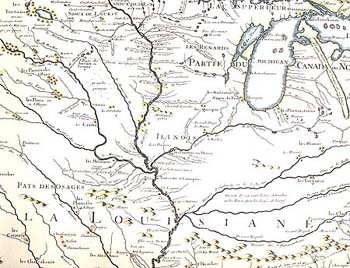
| Detail from "Carte de la Louisiane et du cours du Mississipi" (map by Guillaume Delisle, 1718) enlarge map |
Our Illinois [Indians] inhabit a very pleasant country. . . . the great rivers which water it, the vast and dense forests, the delightful prairies, the hills covered with very thick woods, --all these features make a charming variety. (Gabriel Marest, 1712)![]()
Three-hundred years ago, when French explorers first visited the Illinois Country--the homeland of the Illinois Indians--the natural environment looked very different from the way it appears today. At that time, the landscape was a patchwork of prairies, forests, marshes, and swamps. Bison and elk roamed the upland prairies, bears and mountain lions prowled the forests and swamps, and the skies were often darkened by large flocks of passenger pigeons. Bordering the land were three large streams: the Mississippi, Ohio, and Wabash rivers. To the northeast lay one of the world's largest freshwater lakes, Lake Michigan. These and other aquatic and wetland environments teemed with many different species of waterfowl, fish, and freshwater mollusks.
Today, the Illinois environment has been changed in many ways to meet the needs of a growing agricultural and industrial economy. Prairies have been made into agricultural fields; forests have been logged; marshes and swamps have been drained; and rivers have been dammed. In the process, many species of plants and animals have decreased in numbers or disappeared. To appreciate the natural resources available to the Illinois Indians, it is necessary to look at historical records to see what the environment was like before this change occurred.![]()
|
|
Copyright © 2000 Illinois State Museum