Read More About It - A Landscape Sculpted by Ice
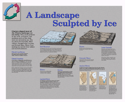
A topographic map of Illinois shows how glaciers shaped the landscape we see today. Large, curved ridges around Lake Michigan in the northeastern third of the state are end moraines that developed at the edge of the ice. Between the moraines, relatively flat till plains formed by the Wisconsin glacier mark the central part of the state. Enormous quantities of water from the melting ice carved the broad floodplains of the Illinois and Mississippi rivers.
South and west of the Wisconsin glacial moraines, gently rolling till
plains were left by the earlier Illinois glaciers. Beyond these, in the
northwest and along the western and southern edges of the state, are rugged,
deeply eroded areas that were not covered during the last two glaciations.