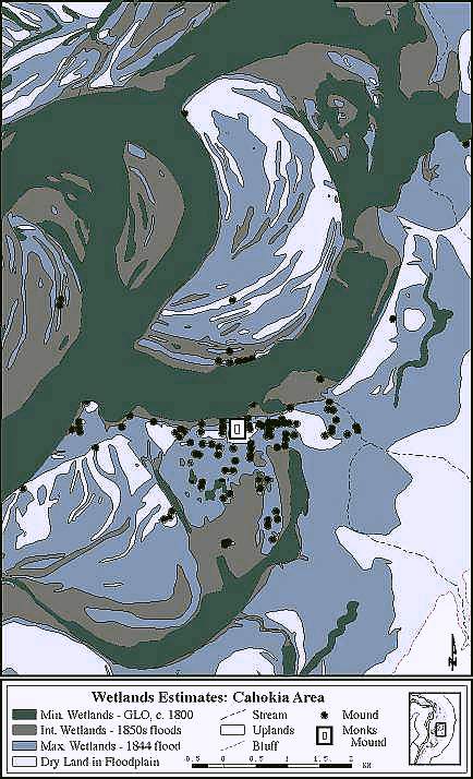
Milner & Oliver map showing location of mound sites and historic wetlands.
One recently recognized and particularly interesting aspect of the spatial arrangement of Mississippian mounds in the American Bottom is their geomorphic position. Recent mapping of historic swamps, sloughs, and streams (using Public Land Survey records) shows that Mississippian and later sites with mounds in the American Bottom are almost universally found next to some sort of water body. Furthermore, at many multiple mound sites, and Cahokia is a good example, the largest mound appears to be located perpendicular to the water body with other mounds arranged around a plaza, with the main plaza axis also laying along this perpendicular.
Mississippian plazas vary tremendously in size, but they all share a roughly square to somewhat rectangular shape. In almost all sites with multiple mounds the mounds surround the main plaza area. This is clearly communal space for civic and religious functions, some of which were no doubt directed by a priest-chief on a surrounding mound. It is worth noting that these plazas are not simply areas demarcated by surrounding mounds. Research on Cahokia's Grand Plaza shows that not only was this 40+ acre area artificially leveled, it was also artificially raised with dirt brought in from elsewhere.