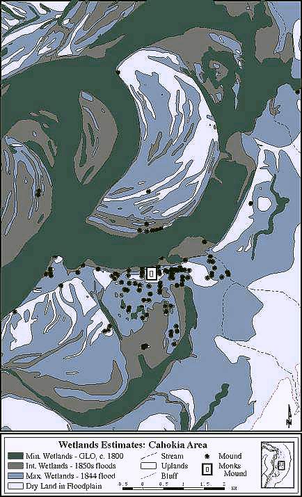
Wetlands estimates for the Cahokia Mounds area of the American Bottom based on GLO documents and historical data on flooding in the 1850's and in 1844.
J.S. Oliver (Illinois State Museum-RCC, GIS Laboratory), & G.R. Milner (Penn State Univ.). SEE ALSO Milner, G.R. 1998. The Cahokia Chiefdom: The Archaeology of a Mississippian Society. Smithsonian Institution Press, Washington.