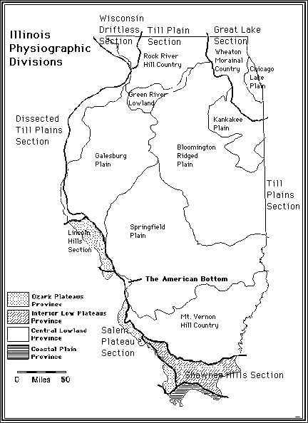
Physiographic divisions of Illinois.
|
Physiographic divisions of Illinois.
|
The American Bottom lies on the western edge of the Central Lowland Province between two eastern fingers of the Ozark Plateaus Province (the Salem Plateau and the Lincoln Hills Sections). One can infer from the adjacent map that the creation of the American Bottom is related to the bedrock geology of this part of the Mississippi River valley: Here the ancient Mississippi River flowed on softer, more easily eroded Pennsylvanian coal-bearing bedrock of the Central Lowland Province (the Springfield Plain). In contrast, the basement rocks to the north and south are the less erodable Mississippian limestones of the Ozark uplift dome. By the end of the Pliocene, the Mississippi River had eroded the bedrock forming its current bedrock trough through which it has flowed and deposited sediments ever since (HDYK-ENV). |