 The course of the Mississippi and the Formation of Bloody Island
The course of the Mississippi and the Formation of Bloody Island
The course of the Mississippi and the Formation of Bloody Island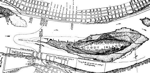 |
| A detail of the 1843 East St. Louis/St. Louis area survey. |
Beginning around 1800, the river began to change course, moving closer to the Illinois side and further from St. Louis, threatening the city with becoming land-locked. A sandbar on the Illinois side appeared just above Illinoistown. The original riverbank began to erode with the increased flow of water against it. Not long after the appearance of this sandbar one grew on the Missouri side, filling in the gap between the shore and the sandbar. During the next twenty years the sandbars continued to grow. The southwestern sandbar became known as Duncan's Island while the much larger sandbar on the Illinois side was called Bloody Island. The name came from the sandbar's popularity as a dueling field due to its neutral location, technically outside of both states.