
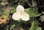
(Trillium grandiflora) |
This section explores seven types of Illinois forests. You will see a panorama of each type, plus two panoramas within the Upland and Swamp sections' text. These panoramas contain interactive spots. As you hold down your mouse button to move the panorama, watch for your cursor to change to a globe. The globe indicates there is more information - you can click to find more details about species. |
Today, Illinois boasts a rich diversity of forests. They dominate the landscape in the southern part of the State, where they range from dry upland forests to cypress swamps. Throughout the rest of the state they exist as groves or savannas in the middle of prairies, or along streams and rivers.
What factors determine the distribution of forests?
Climate,
topography,
and soils control the distribution of forests and types of forests within
Illinois. These factors vary considerably over the 400 miles from north
to south.
The
amount of water available influences the presence of forests.
Average
annual rainfall (calculated for 1961-1990), for example, is ten to
twelve inches greater in the southern portion of the state than in the
northern counties. The seasons in which precipitation
falls also varies from north to south. The southern part of the state has
a precipitation maximum in winter, the central part in early summer, and
the northern part in late summer/early fall. Abundant winter moisture is
an important factor favoring forests in the southern part of the state.
Average
Temperature
Annual
mean temperatures are also higher in the south, with the extreme southern
counties having a normal annual
mean temperature (map calculated for 1961-1990) that is about eight
degrees higher than the northern counties.
Climate
The average
length of the frost-free growing season is greater in the southern portion
of the state, with the first frost usually occurring late in October. The
first frost occurs early in October in the northern part of the state.
In northern Illinois, winters are cold and summers are cool enough to support eastern white pine, a northern conifer. The climate in the south, with its mild winters, hot summers, and abundant moisture, supports southern species such as bald cypress, tulip tree, and sweet gum.
The
Prairie Peninsula and the forests of Illinois
The Prairie
Peninsula (use back button to return here) occupies the central portion of the state. This wedge of grassland projects eastward from the Great Plains into the Midwest, stretching from western Iowa to Indiana, with outlying islands as far east as Ohio. Deciduous forest occurs both north, south, and east of the Prairie Peninsula.
Drought
Although average precipitation in the Prairie Peninsula differs little from the surrounding forested regions, (as shown here by the map within the Midewin NTP Web exhibit) droughts
are more frequent and severe. Low moisture levels are stressful and
directly harmful to tree growth. Dry conditions favor wildfires. Young
trees in particular are sensitive to consecutive years of severe drought.
During the drought of 1913-1914, thousands of young trees along the prairie-forest
border died.
Drought
and Fire
Drought conditions also increase the probability of fires that kill young trees and damage mature, fire-sensitive species. Drought and fire prevent the forest from invading the prairie. They also control the composition of forest groves within the prairie because the tree species will be the ones that can survive drought and fire.
The flat, relatively empty surface of the Prairie Peninsula makes it possible for fires to spread for miles before encountering a firebreak such as a stream. In addition, the tall-grass prairie vegetation produces a large amount of highly flammable fuel. When fires occurred annually during seasonal dry periods in autumn, they burned large portions of the prairie and effectively prevented the expansion of forest.
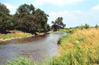 |
| Prairie Creek at Midewin National Tallgrass Prairie |
Groves, savannas, and upland forests occur in areas of the prairie that are protected from fire. Streams, rivers, and broken topography slow down the spread of fire. These areas still burn frequently, and the dominant trees, such as bur oak, are highly resistant to fire. The southern part of the State was heavily forested because of higher rainfall and broken topography that prevented the rapid spreading of fire.
|
|
Copyright © 2000 Illinois State Museum