|
ISM Web offerings for Geography
 - Lewis and Clark in Illinois
- Learn about what Lewis and Clark did, whom they met, and what they saw in Illinois during the winter of 1804 when they were preparing for their epic journey to the West.
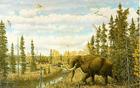 - Midwestern U.S. 16,000 Years Ago Web Exhibit
- This Web exhibit features the extinct large mammals such as mammoths and mastodons, as well as smaller mammals that live here today. It explains the four possible reasons for extinction.
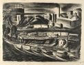 - Of Time and the River
- "Of Time and the River" is an educational Web site combining geology, archaeology, history, environmental science, and the changing ecology of the Illinois River to tell the story of this river during 12,000 years of human use. Our focus is a problem known as Non-point Source Pollution - pollution in the Illinois River from diffuse sources and not from a single point of origin nor introduced into the river from a specific source.
 - Be a Pioneer Lesson
- In this Harvesting the River Online lesson, middle schoolers will play roles of pioneers and make decisions along the way to Illinois and their new home in the mid-1850s.
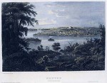 - Beautiful and Sublime Landscapes in Illinois
- This lesson from Lewis and Clark in Illinois describes the 18th and 19th century aesthetics that influenced Lewis and Clark when they went West. Look at three of the Museum's 19th century landscapes, then create you own using this aesthetic.
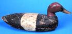
 - Commercial and Sport Hunting Lesson
- This lesson from Harvesting the River Online asks students to look at the abuses of market hunting in the early 20th century led to new laws, which in turn led to sport hunting.
- Compare and Use Maps
Compare and Use Maps lesson shows how maps and other geographic representations and instruments are used to gather information about people, places and environments. Go To RiverWeb, Mississippian, Technology Activities and scroll to the bottom. Click on the pdf link.
 - European and Native American Mappping Activity
- European and Native American Mapping Activity from Lewis and Clark in Illinois helps students understand how different peoples have different cultural traditions about subjects even as seemingly "scientific" as measuring the land. Lewis and Clark consulted several sources for maps and brought with them scientific tools for measuring land and making maps.
- Land Survey Lesson Plan pdf
- Surveyors went through Illinois in the early 1800s, measuring and recording the land and marking it into townships so that the land could be sold to farmers and other settlers.
 - Unit Plan for Harvesting the River Online
- A unit plan helps high school students explore the social and economic history of the river towns. Each student will role-play an individual in the community while researching a vocation and its place in the community, then write a first person report on their findings. Students can use the audio and video files as well as the Web site narratives as resources in their research.
|
|
|