54th annual meeting of the Society of Vertebrate Paleontology, Seattle, Washington. Oct 19-22, 1994;1995 Midwest/Great Lakes ARC/INFO User Conference, Champaign, Illinois. September 27-29, 1995.
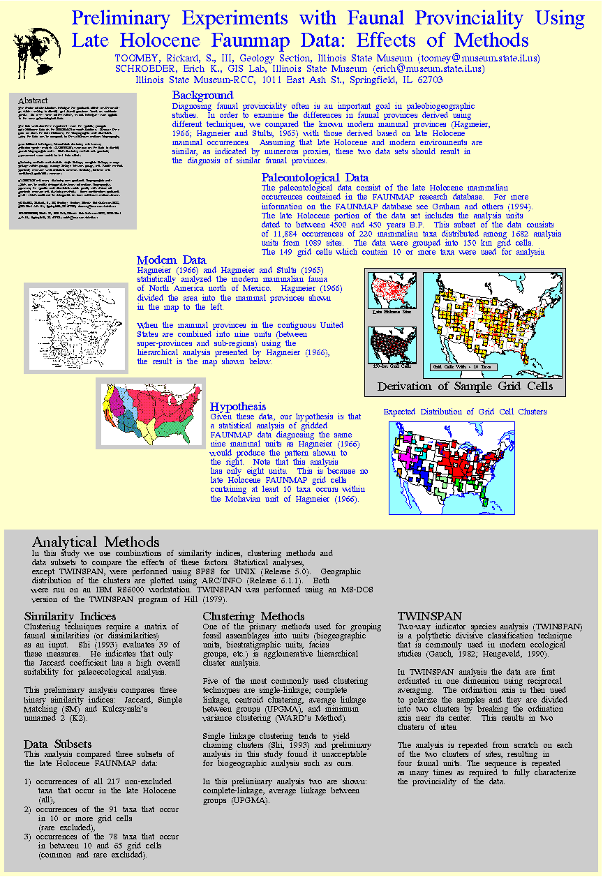
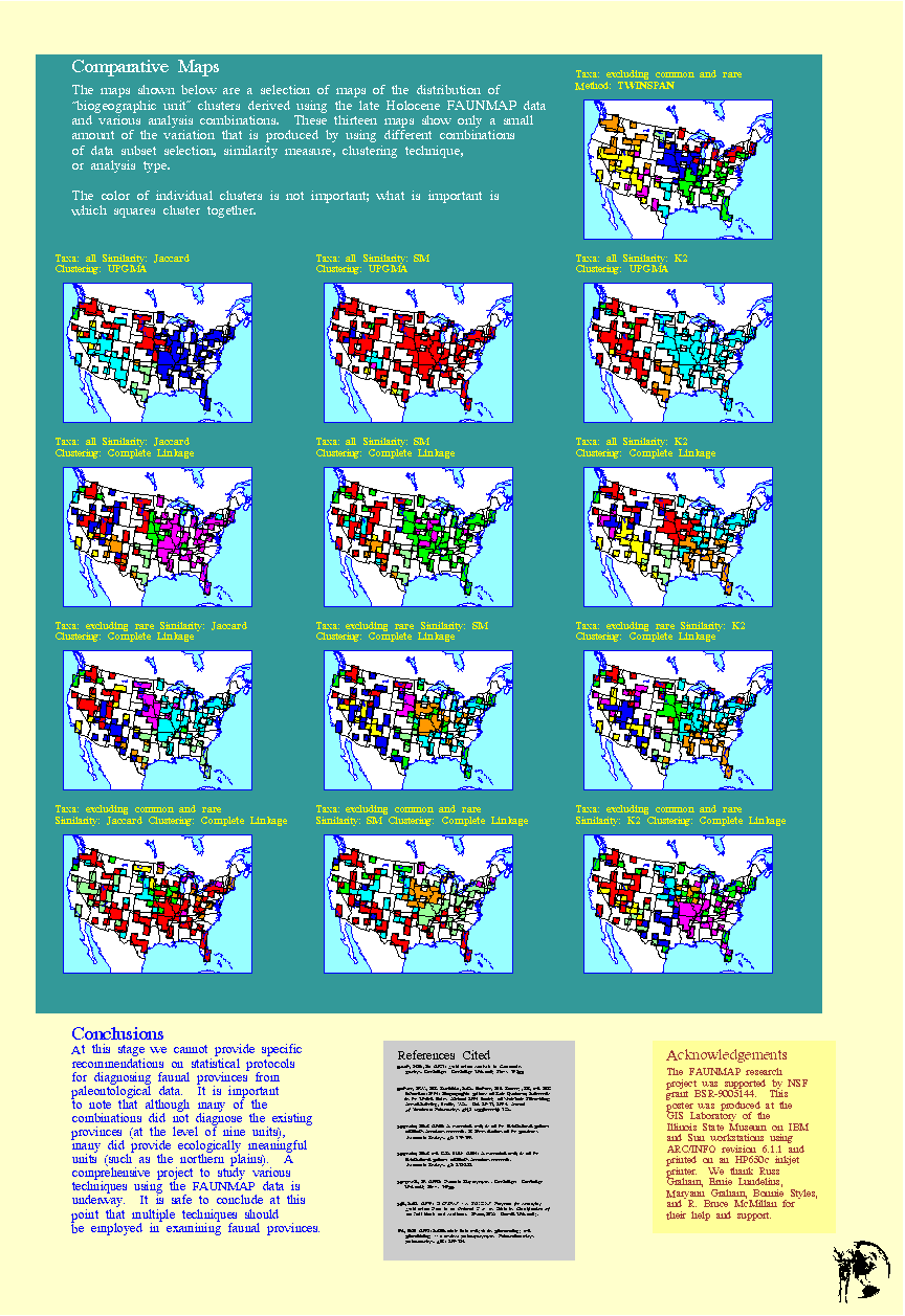
The data used for these experiments were the spatially grouped Late Holocene data in the FAUNMAP research database. Because these data are from the Late Holocene, the biogeographic units identified using the data can be compared to the well-known modern biogeography.
Two different techniques, hierarchical clustering and two-way indicator species analysis (TWINSPAN), were run on the data to identify faunal biogeographic units. Both clustering method and proximity measurement were varied to test their effects.
Clustering methods used include single linkage, complete linkage, average linkage within groups, average linkage between groups, and Ward's method. Proximity measures used included common similarity, distance and conditional probability measures.
TWINSPAN and many clustering runs produced biogeographic units which can be readily interpreted in terms of modern biogeography. However, the specific units identified varied greatly with choice of proximity measure and clustering methods. Some combinations produced results which could not be interpreted in terms of known modern faunas.
TOOMEY, Rickard, S., III, Geology Section, Illinois State Museum-RCC, 1011 East Ash St., Springfield, IL 62703; toomey@museum.state.il.us
SCHROEDER, Erich K., GIS Lab, Illinois State Museum-RCC, 1011 East Ash St., Springfield, IL 62703; erich@museum.state.il.us
© Illinois State Museum -- Last updat ed 04-Sep-96 by Erich Schroeder