HI,
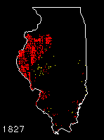
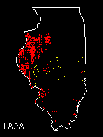
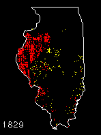
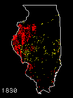
Here is
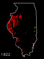
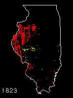
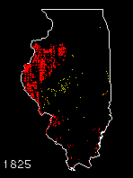
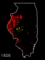
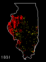
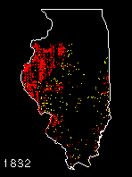
a series of Illinois maps on the screen. These are based on the database of
public domain land records that I have been working with for a while.
In these maps (1822-1832) the yellow specks are sections (square miles) in
which there were one or more transactions during a year. Red specks are
sections that were entirely in private ownership by that year.