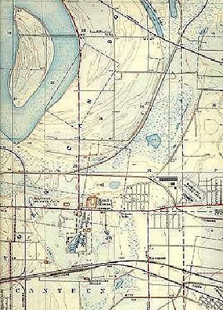
Portion of USGS 7.5' 1935 Monks Mound quadrangle map showing subtle relief of American Bottom. Contour lines are at 5 feet intervals. Horseshoe Lake is at upper left, Monks Mound and Cahokia Mounds site are below center.
United States Geological Survey, Monks Mound 7.5' quadrangle.