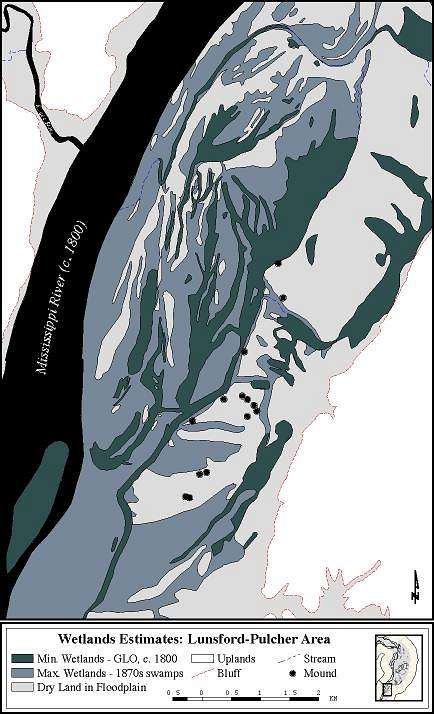
Wetlands estimates for the Lunsford-Pulcher Mound group area of the American Bottom based on GLO documents and historical data from the 1870's.
J.S. Oliver (Illinois State Museum-RCC, GIS Laboratory), & G.R. Milner (Penn State Univ.). SEE ALSO Milner, G.R. 1998. The Cahokia Chiefdom: The Archaeology of a Mississippian Society. Smithsonian Institution Press, Washington.