Harvesting the River
Harvest Transport History

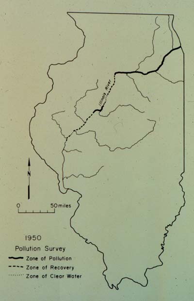
Home > Archives > Images and Photographs> Map showing zones of heavy pollution in 1950 from industrial sources near Chicago and in Peoria. It shows a small area of clear water south of the mouth of the Sangamon River north of Beardstown.


Top Level : Harvesting : Fish

Map showing zones of heavy pollution in 1950 from industrial sources near Chicago and in Peoria. It shows a small area of clear water south of the mouth of the Sangamon River north of Beardstown.

Map showing zones of heavy pollution in 1950 from industrial sources near Chicago and in Peoria. It shows a small area of clear water south of the mouth of the Sangamon River north of Beardstown.
Images Videos Audio clips

Archives
(-)Archives
    Introduction
    (-)Images
        Top Level
        Harvesting
        Transportation
        History
    (-)Audio
        Top Level
        Harvesting
        Transportation
        History
    (-)Video
        Top Level
        Harvesting
        Transportation
        History
    Top


State of Illinois Dept. of Natural Resources Illinois State MuseumSearch